 |
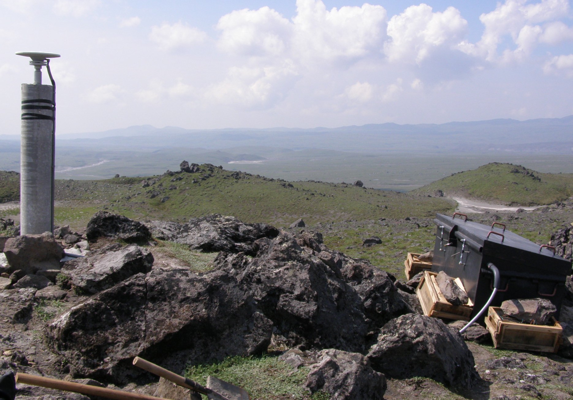
Both campaign and continuous GPS are being used to monitor deformation at Bezymianny volcano. In campaign GPS, small temporary setups are deployed for only a few days. Continuous stations are more permanent and have enough power to operate for a full year. Both types use Zephyr geodetic antennae (shown at left). For more detailed information about the GPS network click here Photo of continuous GPS set up by Gwyneth Hughes |
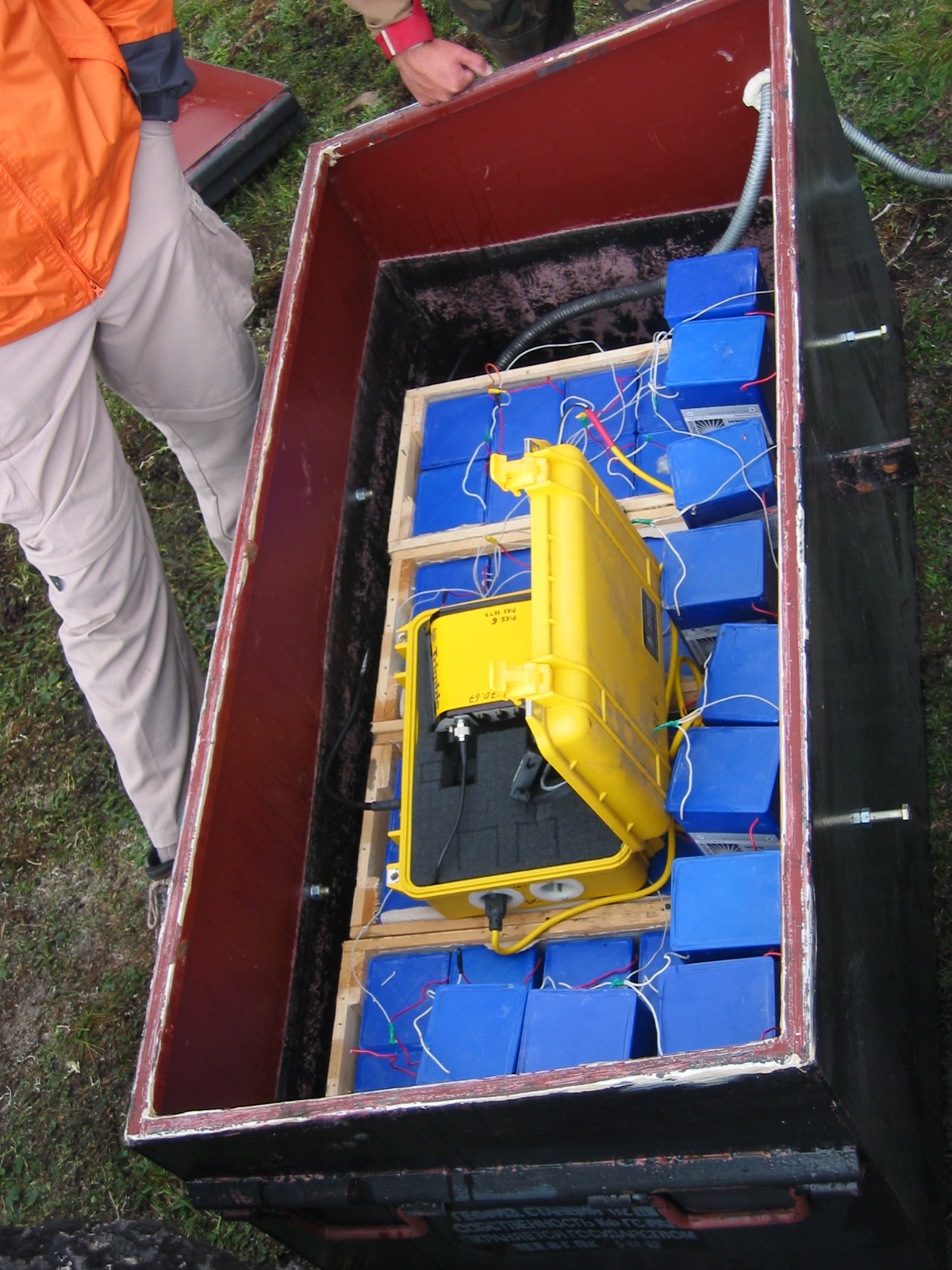
| Continuous GPSThe continuous measurement of crustal deformation at Bezyimianny will be used to constrain the depth and geometry of magma storage and transport within the crust. A total of at least 10 continuous GPS sets should be operating on Bezymianny by the end of this year. Last year, six stations collected data from October '06 through May '07, capturing the December 2006 eruption and any deformation prior to the May 12th 2007 eruption. During the summer of 2007, the GPS team downloaded data from the continuous receivers (NetRS), modified the holding boxes to be more weather resistant, and replaced batteries (see picture at left). Photo of GPS receiver and batteries by Gwyneth Hughes |
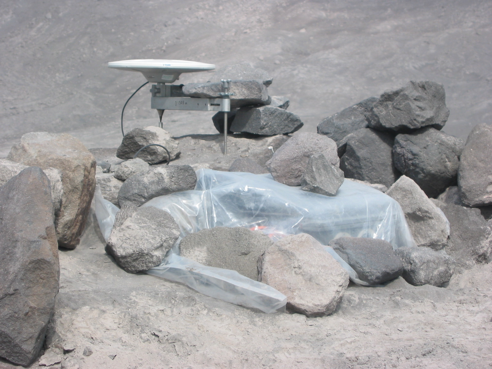
| Campaign GPSFour campaign sites around Bezymianny were surveyed in 2005, 2006 and 2007. By resurveying points each year, we will be able to better constrain the precise locations of the newly added continuous stations Photo of Campaign by Hughes |
Partnership for Volcanological Research and Education